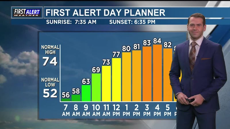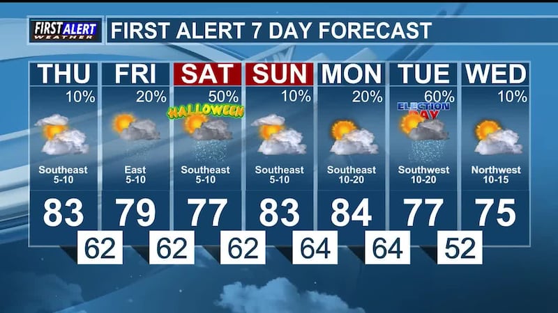
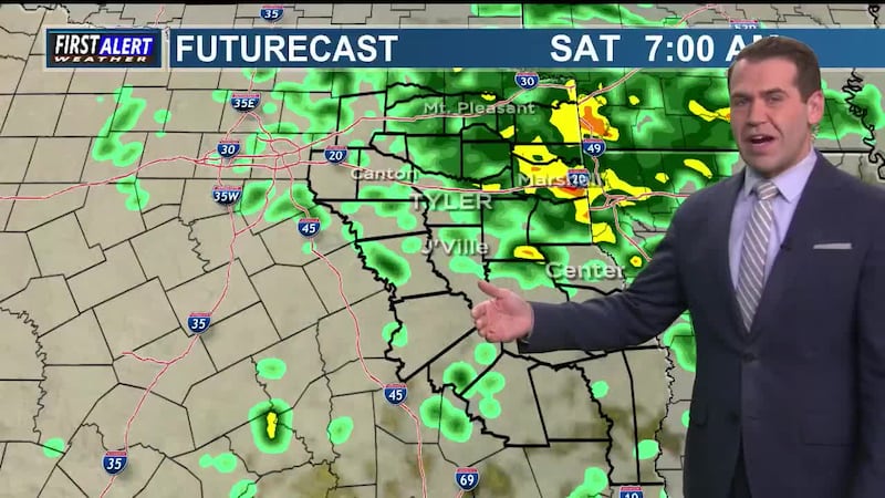

The forecast remains dry through Thursday, despite mostly cloudy to overcast skies that are expected through early next week. Chances for rain will return to East Texas on Friday and increase Saturday (Halloween). Additional chances for rain are in the forecast for Monday and Tuesday to begin next week. At this time, the Storm Prediction Center does not have East Texas under a risk for severe weather at any time with these shower and thunderstorm chances. We'll continue to monitor for any changes and share those as we get them.
Today in weather history... October 28, 2020, Hurricane Zeta made landfall in Louisiana as a Category 3. The storm beat the 1921 Tampa hurricane as the latest Category 3+ to strike the US in a calendar year. Zeta killed six people and produced nearly $4 billion in damage in the United States. Today's daily weather history segment comes to us courtesy of the Southeast Regional Climate Center.
This week's weather word is "raffiche." (Also refoli.) In the Mediterranean region, gusts from the mountains; violent gusts of the bora. This definition comes from the American Meteorological Society's Glossary of Meteorology (2026).
Also on today's edition of First Alert Weather Extra... continued updates on the record King Tides, as well as new details on a potential dwarf planet beyond Pluto. In closing, our satellite imagery of the day, showing flooding in the Four Corners after heavy rain, courtesy of the Cooperative Institute for Research in the Atmosphere.
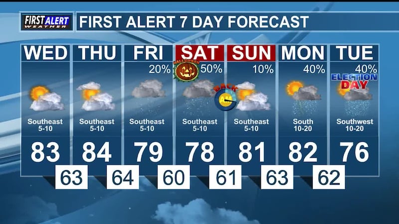
Happy Wednesday, East Texas! We'll see mostly cloudy to partly cloudy skies this afternoon as temperatures warm into the lower 80s. While the forecast for East Texas is dry, there is a chance for rain to our southwest, and a few showers could make it to the Trinity River and pass into the fringes of our viewing area. We continue to forecast chances for showers and thunderstorms on Friday and Saturday (Halloween), as well as Monday and Tuesday (Election Day). At this time, the Storm Prediction Center has not placed East Texas under any risks for severe weather for either of these periods of rain. That said, we do know that showers and thunderstorms could be disruptive for high school football, trick-or-treating, and voting over the next week. Please monitor the forecast and plan accordingly. Have a great day!